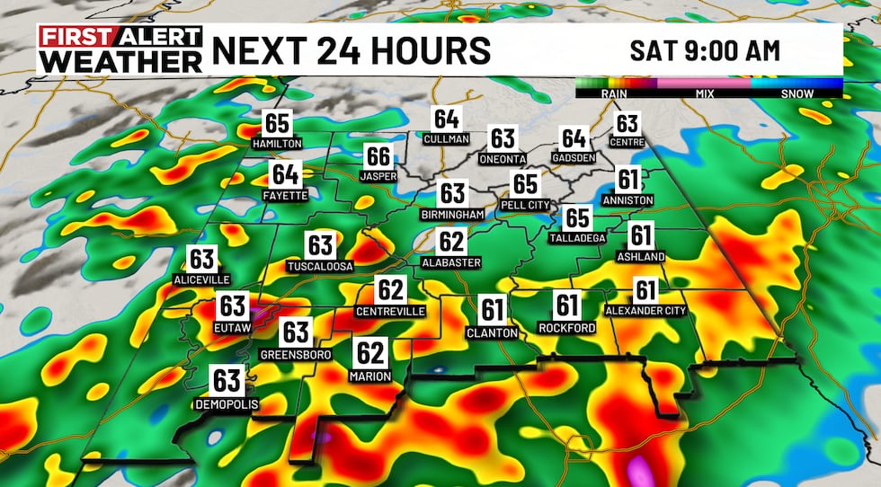
BIRMINGHAM, Ala. (WBRC) – We are tracking strong storms in east Alabama Thursday night producing heavy rain, possible hail, and gusty winds. We’ve already had some hail producers earlier today and this risk will continue through tonight.
Otherwise, we should have some cloud breaks for the start of the Total Lunar Eclipse this evening. Hopefully, we continue to see some cloud breaks as the eclipse peaks past midnight.
We’ve dropped the alert day for Friday because dry weather is expected for most of the day. It will be windy, with highs nearing 80º.
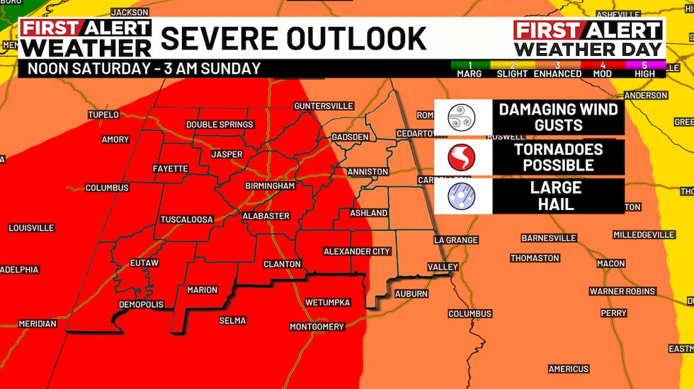
The setup for Saturday is shaping up to be a particularly dangerous situation. Increased instability and wind shear will lead to the risk of severe storms Saturday morning capable of producing tornadoes. Know that if storms end early Saturday, that is not the main event as another round of severe storms and tornado risk materializes in the afternoon and continues through the evening.
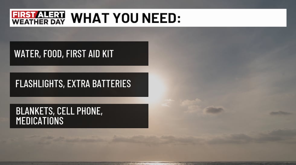
- Have Multiple Ways To Receive Alerts
- Have A Plan
- Help Spread The Word
- Stay Weather Alert
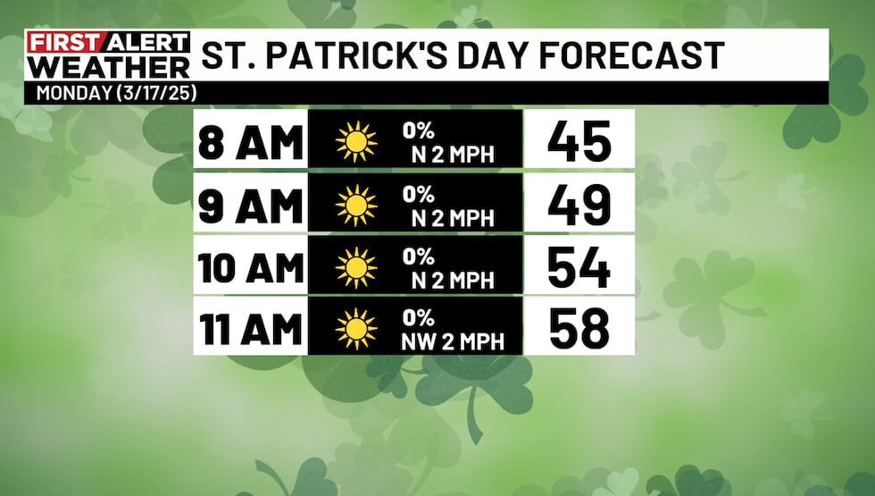
Conditions will improve on Sunday, with dry weather and seasonal conditions for St. Patrick’s Day. Another cold front will bring a chance for showers and possibly a few storms around the middle of next week. However, no organized severe weather is expected at this time.
Stay weather alert with the FREE WBRC First Alert Weather app on Android and Apple devices and the WBRC Streaming App for Roku and Fire TV.
Get news alerts in the Apple App Store and Google Play Store or subscribe to our email newsletter here.
Copyright 2025 WBRC. All rights reserved.